Emma Down, Deputy Head of Archives, writes: The UK Hydrographic Office (UKHO) is very grateful to the Friends of Nations’ Libraries for their support in purchasing a ‘Chart shewing the land Discovered by HM Ship Investigator between September 1850 and October 1851’ by Stephen Court, Second Master.
The most complete of its kind, this survey depicts the tracks of HMS Investigator, under the command of Robert McClure, between 1850 and 1851 during its search for John Franklin’s ill-fated expedition to the Arctic. HMS Investigator had originally set out with HMS Enterprise under Captain Collinson, but they became separated off the coast of Chile. McClure, who had already visited the Arctic with George Back in 1836-7 and Sir James Clark Ross in 1848-9, continued north and the ships did not meet again on their expedition.
The survey is significant because it shows the tracks taken in 1850 when the ship entered Prince of Wales Strait but was halted by pack ice. McClure climbed a hill at Point Russell and looked across the frozen expanse and observed Melville Island from Banks Island, with no land connecting them. The ice was too thick to pass via ship so the voyage instead wintered in the Strait before navigating south and moving clockwise around the Baring Island, before sledging across to Winter Harbour on Melville Island in 1851 and physically completing the Northwest passage. The crew later abandoned the ship in 1853 before returning home to Britain with the Belcher expedition. The wreck of HMS Investigator was discovered in 2010 by Parks Canada.
Part of a collection of 11 items from the voyage by HMS Investigator held by the UKHO Archive, this survey details the ship’s passage across northern Canada. Included in the collection is the log book from the expedition, also penned by Stephen Court. On Sunday 27th October 1850 he described ‘ … having satisfied ourselves beyond doubt that the waters that our ship was now in communicated through Barrows Strait with those of the Atlantic and consequently that we were the Fortunate Discoverers of the long sought NW Passage … having packed our sledge and given three Cheers and spliced the Main Brace we commenced our return … ’. On his return, McClure was credited with discovering the North West Passage by sea and sledge and was awarded a share, with the crew, of the Parliamentary prize for the expedition. McClure Strait is named after him.
The survey was drawn by Stephen Court who was second master on board HMS Investigator and was part of the sledge party who discovered the North West Passage in October 1850. Like McClure, Court had visited the Arctic previously with Sir James Clark Ross’ expedition in 1848-9. A skilled draughtsman, Court made a number of surveys during the voyage. This survey is by far the most detailed including dozens of placenames, detailed remarks on the state of the pack ice and conditions in which the crew were working, information on the presence wildlife and details of the ship’s wintering places.
The survey, along with the others from the voyage, is now part of a featured collection on our catalogue and is available to the public for research in our reading room. This survey and others from the collection featured in a number of pop-up exhibitions throughout 2023-2024.
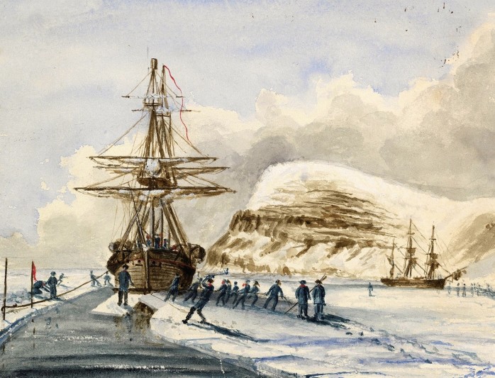
A painting by Samuel Gurney Cresswell of HMS Investigator and HMS Enterprise cutting through the ice, from his archive that was acquired by Norfolk Record Office with FNL’s assistance in 2012 and is shown to the right.
