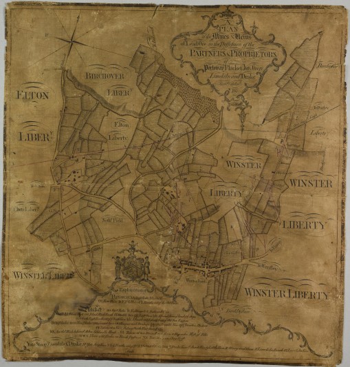
Winster is a beautiful and historic village in the Peak District National Park. In the mid-18th century it was a prosperous lead mining town but when the mines flooded, the industry died and the population shrank. The village’s former prosperity is visible in the fine buildings that line Main Street, including Winster Market Hall, which is now owned by the National Trust. Unfortunately, Winster and its neighbouring villages of Birchover and Elton are not well mapped and the Record Office had no earlier maps than the first edition of the Ordnance Survey, which was surveyed 1875-1882. Purchasing the beautifully drawn Plan of the lead mines and veins of the Partners and Proprietors of Portoway Placket Yate Stoop Limekiln and Drake, Winster, dated 1769, was a wonderful opportunity to fill a gap in the historical record.
The plan was surveyed and delineated by ‘Nuttal’ on behalf of a group of investors that included the Duke of Devonshire and local gentry families such as the Thornhills and Peter Nightingale (who built a substantial fortune which on his death passed to the father of Florence Nightingale). ‘Nuttal’ was John Nuttal, a local man who surveyed and/or drew other plans of lead mines in Derbyshire, several of which are at Derbyshire Record Office.
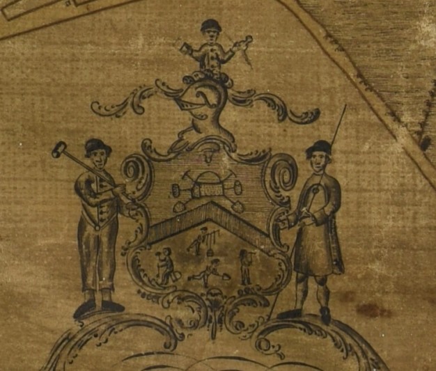
At the time this map was drawn, the Peak District was the most important lead mining area in the world and had already developed unique customs and traditions. The map clearly marks the lead mine ‘rakes’ around Winster, providing geographical and economic information about the local industry. Embellishments on the map also give additional information, with charming drawings of lead miners showing us their dress and the tools that they used, as well as curious symbols which will likely intrigue researchers for years to come.
The map also shows the layout of Winster in its heyday, more than 100 years before the earliest Ordnance Survey mapping, and the neighbouring villages of Elton and Birchover are also depicted. For local historians this is invaluable, with buildings and field boundaries clearly marked and identifiable. The map also reflects a much earlier history of the area; the ‘Portoway’ of the map’s title is the Derbyshire Portway, a prehistoric trackway running past Winster on its route between Mam Tor and the edge of Nottingham.
The Record Office is delighted to have acquired such an early map of an area which is of enormous cultural, archaeological and geological interest, and is now exploring ways to share the wealth of information in this map directly with the local community and visitors to Winster.

