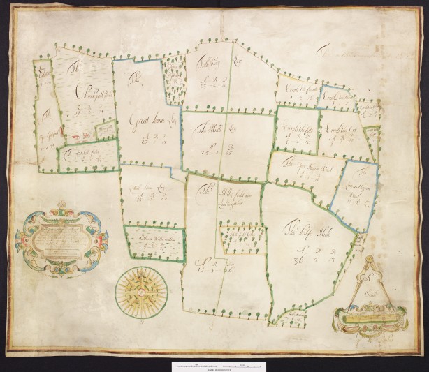
Drawn in 1664 by Robert Whi(s)tpaine from a survey of 1659 by Ralph Dowcett, the plan shows a farm in ‘Tollesbury’ (recte Tolleshunt D’Arcy) owned by the Henry Smith Charity. This charity was established in 1628 under the will of Henry Smith and benefitted a large number of parishes in Essex and elsewhere, and the title of this map names in particular the parish of Southover in East Sussex. Consultations with the East Sussex Record Office established that the Southover parish records include accounts for income from the farm, but as the property itself lay in Essex, and the Essex Record Office already holds other records of the charity, it was agreed that the ERO should make a bid.
ERO already holds large numbers of manuscript estate maps. Quite apart from their aesthetic value, they underpin many studies of local history and geography in the early modern period. This is a competent and attractive example, of special interest firstly because little is known of the surveyor, Ralph Dowcett, although he may have come from the Terling area of Essex. He is known from only a small number of surviving works, and is not known to have worked before 1659, the date of this survey. The leading expert on Essex estate maps, the late A.S. Mason, noted Dowcett’s ‘sparse career … characterised by the increasing size of the lands mapped and the increasing importance of the land owners who employed him’ (ERO T/Z 438/2/1). Only five Essex surveys are known, one of these being a map held among the Charterhouse records in the London Metropolitan Archives. Two further Essex maps, together with later copies of two lost originals, are in private hands; the ERO holds photographic copies of these.
The present map (ERO D/DU 4032/1) was previously unknown to ERO, and it will add greatly to the corpus of Dowcett material available to researchers. The actual mapmaker, Robert Whi(s)tpaine, is not currently represented in ERO’s collections, and so far as we knew he operated only in Sussex. His collaboration with this Essex surveyor was previously unknown and opens a new line of enquiry to students of cartographical history. Another point of importance is that the map predates any of ERO’s existing mapping of this parish, and so is notable evidence of local topography and land use. The map also predates any of the records of the Henry Smith Charity currently deposited in the ERO, and so provides important evidence of the early period of the charity’s existence.
